Visual Sign Parsing & 3D Grounding

Navigational Sign Taxonomy

A research-oriented taxonomy organized by where signs appear, what they encode, and how they update navigation state.

Sign → information type → structured information → navigation-state update

1. Navigation information flow

Different sign types support different stages of a journey.

Where is my goal?
Goal localization
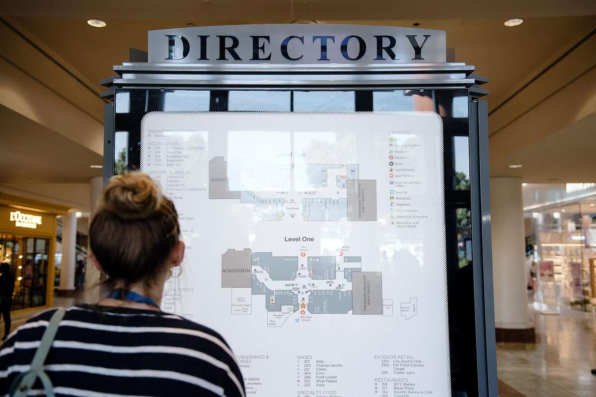
DirectoryFloor plan
Which way now?
Route decision
DirectionalFingerpost
How do I change level?
Transition
LiftStairsEscalator
Still right / arrived?
Confirmation
ReassuranceIdentification
Constraint / Dynamic signs can modify any stage: No Entry, Lift Out of Service, Detour, temporary closures, etc.

2. Real-world visual context

Representative contexts for routing, vertical transition, and map-based localization.

3. Seven navigation-relevant classes

Each class has a different natural output and a different 3D grounding problem.

Directional Sign

corridor · junction · airport · mall · hospital
Real-world hospital directional signage
Real-world hospital directional signage. Photo: PaulSyms22 · Wikimedia Commons
Visual pattern
Destination + arrow + optional pictogram; often several destination–direction pairs.
Function
Choose the next local branch.
State update
destination → candidate path / bearing
3D challenge: Map a 2D arrow to the correct traversable corridor in 3D, especially with overlapping branches or oblique sign views.

Vertical-transition Sign

lift lobby · stairs · escalator · multi-level hub
Airport sign directing travelers to elevator and escalators/stairs
Airport sign directing travelers to elevator and escalators/stairs. Photo: Bri · Wikimedia Commons
Visual pattern
Floor number/range + arrows + lift/stairs/escalator icons.
Function
Select a vertical connector and target level.
State update
floor_i —connector→ floor_j
3D challenge: Disambiguate whether ↑ means straight ahead, upstairs, or up escalator; reason over explicit multi-floor topology and Δz.

Directory

entrance · lobby · elevator core
Floor directory in a hospital entrance lobby
Floor directory in a hospital entrance lobby. Photo: Cerevisae · Wikimedia Commons
Visual pattern
Dense destination–floor or destination–zone listing.
Function
Coarse goal localization.
State update
destination → {floor, zone}
3D challenge: Translate symbolic floor/zone information into a building-level topological goal even when the destination is not visible.

Map / Floor Plan

mall · hospital · campus · museum · station
Floor map with “You are here”, stairs, lifts and destinations
Floor map with “You are here”, stairs, lifts and destinations. Photo: Ciara Ní Riain · Wikimedia Commons
Visual pattern
Schematic geometry + labels + legend + You Are Here.
Function
Localization + global route planning.
State update
2D schematic → topological / metric graph
3D challenge: Align a schematic map to the robot/world frame and recover vertical connectors across floors.

Outdoor Fingerpost / Pylon

campus · park · plaza · trail
Outdoor fingerposts at Jurong Bird Park, Singapore
Outdoor fingerposts at Jurong Bird Park, Singapore. Photo: Marcin Konsek · Wikimedia Commons
Visual pattern
Multiple physical panels or one pylon, often with distance.
Function
Choose an outdoor heading/path.
State update
destination → world-space heading
3D challenge: Physical panel orientation may carry the direction; cropping the sign can remove the decisive 3D cue.

Identification / Reassurance

along route · floor landing · destination entrance
Destination identification sign mounted at the room entrance
Destination identification sign mounted at the room entrance. Photo: Beyond My Ken · Wikimedia Commons
Visual pattern
Destination name, room/floor number, or continue-straight cue.
Function
Confirm route state or goal arrival.
State update
belief(route/goal) ↑
3D challenge: Associate a sign with the correct physical room/building/floor and distinguish confirmation from a new action.

Constraint / Dynamic Sign

temporary closure · staff-only · detour · live update
A physical “No Entry” sign constraining traversability
A physical “No Entry” sign constraining traversability. Photo: Pivan0009 · Wikimedia Commons
Visual pattern
No-entry/restricted icons, temporary boards, printed notices, digital messages.
Function
Modify traversability or override stale prior knowledge.
State update
edge available → blocked / redirected
3D challenge: Ground a restriction to the correct door/path/connector and update the graph temporally.

4. Research matrix

How each sign type maps into a robot’s internal navigation representation.

ClassState updateRepresentationKey 3D challenge
DirectionalNext branchPath / bearing2D arrow → 3D path
Vertical transitionFloor / connectorMulti-floor graph edge↑ semantics + Δz
DirectoryGoal locationDestination → floor/zonesymbolic floor → topology
Map / floor planLocalization + routeTopological / metric mapschematic → world frame
FingerpostOutdoor headingWorld-space directionsign pose → heading
Identification / reassuranceBelief / terminationRoute-state confidencesign → physical entity
Constraint / dynamicTraversabilityGraph edge availabilityrestriction → edge + time
Project implication. A realistic benchmark should first classify what navigation information a sign provides, then evaluate parsing and grounding with a task-specific target. Treating every sign as “destination + arrow” misses directories, maps, vertical topology, confirmation, and dynamic constraints.